 |
|||
|
|
|||
| ||||||||||
|
|  MIL-D-89009
3.8.9
DCW tile directories. The data in the DCW libraries
are partitioned in a systematic 5 by 5 tile structure based upon
the world-wide Geographic Reference System (GEOREF) (see Appendix
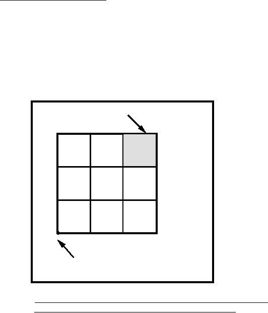
Section 70). The tiling scheme for the DCW libraries implements a
pair of single-digit numbers to represent the 5 by 5 tile
referenced within each 15 by 15 standard GEOREF division. The
first number represents the first, second, or third tile in the x
direction (longitude). The second number represents the first,
second, or third tile in the y (latitude) direction (FIGURE 3).
DCW 5 x 5 TILE MK33
23
13
33
5 x 5
K
15 x 15
32
22
12
31
11
21
M
GEOREF 15 x 15 OFFSET = MK
15 W. Longitude, 45 N. Latitude
FIGURE 3.
5 by 5 tiling scheme of the DCW libraries:
An example from the GEOREF offset "MK".
a. Tile directory hierarchy. The primitive tables for each
coverage are divided among tile directories that are
ordered in a three-tier hierarchy based on the tile
naming convention. The first and second tier
subdirectories contain only pointers to the third
subdirectory, where all primitive tables are stored.
b. Tile directory naming convention. The first tier of
subdirectories has single-letter names from A to Z
(excluding I and O) corresponding to the first GEOREF
letter (longitude zone) in the tile name. The second
tier of subdirectories has single-letter names from A to
M (excluding I) corresponding to the second GEOREF
letter (latitude zone)in the tile name. The third tier
56
|
|
Privacy Statement - Press Release - Copyright Information. - Contact Us |